


In this blog post, Pramit Bhattacharya, a student of Damodaram Sanjivayya National Law University writes about the new Geospatial Information Regulation Bill, 2016 which seeks to regulate and govern all kind of geospatial data. The post highlights the different aspects of the bill and discusses their impact on India’s integrity and sovereignty.

The Geospatial Information Regulation Bill, 2016 has been drafted by the Government of India, which seeks to regulate and control the procurement, distribution, and broadcasting of any kind of geospatial information which can affect the integrity, sovereignty and security of India in any manner. The bill is applicable not only to citizens of the country but also to citizens outside the country, on aircrafts and ships which are registered in India, also persons who are engaged in government service. According to the draft, it will be compulsory to take permission from the government before any geospatial information can be published, broadcast or acquired.

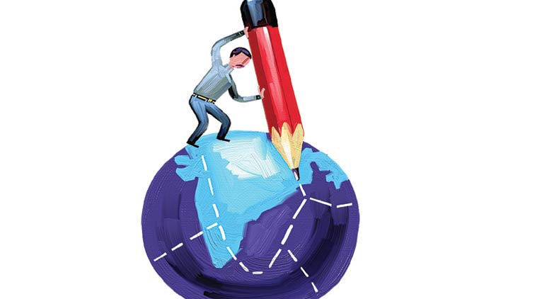
Geospatial Information
The definition and the ambit of “geospatial information” are very wide according to the draft. The definition of geospatial information has been given in such a way that it includes any images or data received through space or any aerial platform. The aerial platforms include satellites, balloons, aircrafts, airships, any unmanned aerial vehicle, etc. The definition also has under its ambit any kind of data which shows any physical feature, boundaries, phenomenon, etc. of the earth. Maps, charts, surveys, terrestrial pictures, etc. also falls under the definition of geospatial information according to the bill. The definition given provided in the bill is so vast that it’ll cover almost everything like GPS enabled devices like cell phones, car navigation systems, drones, balloons, satellite imagery, etc. Not only this, print media like newspapers, magazines and books will also fall under the purview of the definition. Such a wide definition will make the situation very complicated if the bill becomes a law. Almost everyone will have to seek a license from the government to even retain and use the geospatial information. The impact of such a regulation will be widespread. For instance, if a geospatial journal or magazine, say National Geography or Discovery want to publish anything which is even remotely related to some geospatial information, they’ll have to take the prior permission of the government. The editors, publishers and subscribers will also have to take the permission of the government since they will either acquire or broadcast the geospatial information. Any person doing any research related to any geographical issue will also have to take the consent of the government.
Jurisdiction
The jurisdiction which is being given under the bill is also wide. The bill gives an extra-territorial jurisdiction, and if made into a law, it’ll be applicable not only to people residing in India but also to people who are residing abroad. This kind of jurisdiction may not be feasible at all. The main question which arises here is that why would a foreign entity want to submit to a jurisdiction of such an Act which seeks an extensive regulation in distribution and publication of data and information. This may have a negative impact and trade and commerce. This kind of severe regulation will discourage those business houses to set up business in India, which has anything to do with the use of geospatial information (for example foreign cell phone companies whose devices are GPS enabled or car manufacturers who provide a navigation system). The bill talks about licensing all the entities who use any kind of geospatial data. The bill also states that this licensing would be done by a bureaucratic committee, and the data or information would be scrutinized after the data is collected and before it is distributed.
The Authorities
The bill states that an Apex Committee will be set up which will look into the implementation, regulation, and governance of the Bill, which will be in accordance with the policies. A Security Vetting Authority will also be set up and the main aim of this Security Vetting Authority will be to carry out scrutinization and vetting of any kind of geospatial data from the security point of view and provide license and permission to the users to procure, publish, distribute, and broadcast the information, as per the regulations which have been framed. An Enforcement Authority will also be constituted which will look into the enforcement of terms and conditions of the license which has been provided to the user. The Enforcement Authority will have the power to confiscate all the data or resources which have been used for publication or distribution in violation of the Act. The Enforcement Authority will also have the power to impose penalties and revoke or suspend the license of the violators. To hear the appeals against the decisions of the Security Vetting Authority and the Enforcement Authority, an Appellate Authority will be set up, and any person who wishes to appeal against the order or decision of the Appellate Authority can further appeal to the High Court. Thus, to summarize, there will be four authorities to regulate and govern the Act-
- The Apex Committee
- The Security Vetting Authority
- The Enforcement Authority
- The Appellate Authority
The Apex Committee will have the power to delegate its responsibilities but not delegate the regulatory powers. It is the sole authority which can make regulations with regards to the Act. The Apex Committee will comprise of three members. Given the wide ambit of the Act, the authorities may find it very difficult to implement the Act properly. Also having these many authorities for the implementation and monitoring of a single Act can lead to conflict within themselves also.
Licensing

Any person who wants to use geospatial data in any manner, whether to acquire such data, broadcast, publish or distribute such data will have to make an application to the Apex Committee and also to the Security Vetting Authority to obtain the license required to acquire, distribute, publish, or broadcast any geospatial data. A license will also be required if the data is to be used outside India. The license can be suspended or revoked any time by the authorities if the use of any information is in contravention of the Act. The licensee will be supplied with security vetted information, and only that information can be used by the licensee. The licensee shall also display the insignia of clearance by the Authority while using the information. If any loss or damage occurs due to the use of the security vetted information, the licensee will be held liable for such loss. Any person who has acquired any geospatial data before the commencement of the Act will also have to take the permission of the authorities. Such person should make an application to the governing bodies within one year of commencement of the Act for the grant of a license and the permission to retain such data. The governing body has to grant a license or reject the application within three months of receipt of an application.
The issue here is that there are no rules and regulations which state the criteria or requirement for granting or rejecting of license. There is arbitrariness in the granting and revocation of license. There is also no system of check and balance to monitor the activities of the Authorities. This may lead to a lot of arbitrariness on the part of the Authorities. The Bill also states that if the application for the license has been rejected by the Authorities, then the person who applied for a license cannot use or retain any geospatial data with him. This clause also has an ambiguity about it. The Bill does not provide for the way in which such data or information would be disposed of.

Penalties

The draft provides for penalties and fines in case of illegal use of geospatial data. If a person fails to pay the penalty, then such amount would be recovered from the defaulter in the form of land revenues and the defaulter’s license will also be suspended until the penalty is paid. The penalties specified under the draft are exorbitant. The penalties range from Rupees 1 crore to Rupees 100 crore in case of illegal use or distribution or publication of geospatial data. There is also a provision for a penalty which ranges from Rupees 10 lacs to Rupees 100 crore in case India’s map I wrongfully depicted or the license is misused.
It can be said that the proposed bill and the Information Technology Act may be at conflicts because the IT Act deals with any kind of digital data. The IT Act also states that in a case there is a conflict between it and any other Act, the IT Act will prevail. But the bill of the proposed Act also said that in a case of conflict it’ll propose over any other law. This kind of loopholes can be a serious drawback and can make implementation and regulation of the Act very ineffective.
Concluding Remarks
As mentioned earlier, the scope of the bill is very wide. Rather, to wide. Too much law and regulations can also be harmful. The bill needs to be amended to reduce the scope of the definition and make it more streamlined. In order to cover every aspect, it has been given such a broad ambit that instead of regulation it may lead to obstacles and hindrance for the field where geospatial information and data is a necessity. A developing country like ours needs policies to spread information and not laws and policies which are punitive and regressive.
 Serato DJ Crack 2025Serato DJ PRO Crack


 Allow notifications