

In this blog post, Sakshi Jain, a student of Amity University, Lucknow Campus writes about Geospatial Information Regulation Bill, 2016. This bill was published by the Ministry of Home Affairs on 4th May 2016 and is open to suggestions and recommendations of the experts.
Geospatial information means data acquired or received through space or aerial space such as satellite, airship, balloons, aircraft, etc. It also refers to the information collected or related to surveys, maps, territorial pictures, maps, etc. Geospatial information is a digital data showing natural or man-made physical phenomenon, boundaries or features of the earth. Hence, use of map by anyone will need government’s permission first.
Geospatial Information Regulation Bill ensures that any addition or creation within the territory of India related to the geospatial location or its information will need a prior permission of the government. With the permission of the government, the geospatial authority will make any addition or creation to the geospatial information. The bill regulates the distribution, acquisition or publication of geospatial information within the territory of India. This ensures the security, sovereignty, and integrity of India so that it cannot get affected.

Meaning
“Geospatial Information” means geospatial imagery or data acquired through space or aerial platforms such as satellite, aircraft, airships, balloons, unmanned aerial vehicles including value addition; or graphical or digital data depicting natural or man-made physical features, phenomenon or boundaries of the earth or any information related thereto including surveys, charts, maps, terrestrial photos referenced to a coordinate system and having attributes.[1]
About the bill
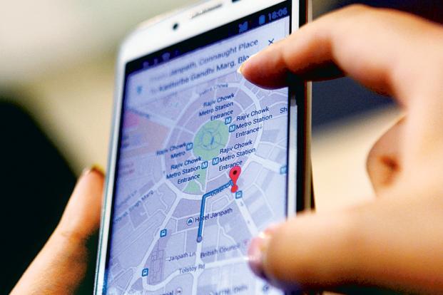
Geospatial Information Regulation Bill, 2016 was drafted and recently published on 4thMay 2016.The bill has not been introduced in either of the houses for approval. This bill aims to make the use of the map of India with the permission of the government a mandatory process. This bill was drafted on the recommendation of Ministry of Home Affairs. Addition to map information or creation or alteration to map and also sharing of location and map-related data is an illegal process if done without a license. For all these purposes, an individual or the organization needs to take approval or license from the government. It would be illegal if it is done without the permission of the government. The bill says that any person who wants to acquire, disseminate, publish or distribute any geospatial information of India has to make an application to the Security Vetting Authority with a requisite fee. This is done for grant of license for using geospatial data and information. It has been stated that with the coming in effect of this Act, one will have to apply for license so that the data a particular organization is using earlier will now need a legal approval to use the same. This Act covers all the businesses and organizations using the maps. It includes not only the business but also an individual. Like Google maps which are used by Google, Ola to find the location of the customer, WhatsApp allows to share the information of location among their friends, etc. one who uses GPS service on their smartphones and have inbuilt GPS in their laptops, etc. have to take a legal license for using this tool after the Act comes into force.
Section 6 of the bill states that ‘no person shall depict, disseminate, publish or distribute any wrong or false topographic information of India including international boundaries through internet platforms or online services or in any electronic or physical form.’[2]
Security Vetting Authority
Security Vetting Authority is there to keep a check over the security of geospatial information in India in a time bound manner. This vetting authority is governed by the apex committee under the Ministry of Home Affairs. This apex committee oversees the functioning and administration of the subordinate committee under this Act by the prevailing National Policies. This Act is not applicable to the governmental bodies. Thus, the security vetting authority grants a license to the organizational bodies or a particular individual who wants to use geospatial data or information. This committee checks the content of the data and make sure that it works within the boundary of national policy. The sole aim of Security Vetting Authority is to provide national security, sovereignty, safety, and integrity. This bill is for the safety of the people of the country. Many organizations use geospatial information for their business purposes and individuals for the purpose of tracking the location and obtaining information. Not only Google but other apps use the information for tracking the location too. New apps like Ola, Uber, Oyo Rooms, Zomato, Housing, WhatsApp, Facebook, Twitter and many more use geospatial information for their business. For personal use, people us GPS to find the location or to tag their picture with a map to the location like in Instagram with geotagging, Facebook with geotagging, etc
Penalties
After the commencement of the Act, if anyone makes use of geospatial information without any license, shall be punished under the Act with an imprisonment which may extend to seven years and shall be liable to pay Rs. One Crore but not more than Rs. One hundred Crore. Therefore, whoever acquires any geospatial information through illegal acquisition, dissemination, publication or distribution is punishable under the Act. Using geospatial information outside India is also a punishable offense with the imprisonment up to seven years and with a fine of Rs. 10 lakh to Rs. 100 crore. The bill penalizes a wrongful depiction of the map of India. The punishment may amount to imprisonment of seven years with fine which may extend to Rs 100 crore.

Conflict between India and Pakistan
The issue was raised when social networking sites showed Jammu & Kashmir to be a part of Pakistan and Arunachal Pradesh as a part of China. After few days, Twitter showed the geographical location of Kashmir in China, and Jammu in Pakistan which created a huge mess and protests from the Indian government and demands for alteration. It was contended that Jammu & Kashmir is a part of India and can’t be depicted as a part of another country.
Pakistan raised this serious issue before UN as it wrote to the Secretary-General stating that India’s map depicted Jammu & Kashmir as a part of India which is factually incorrect. India in its response, says Pakistan should not interfere in the matter of internal issue. Pakistan has no locus standing in this matter.
Criticism
This bill was criticized by many of the people. The experts say that it is impossible and impractical for every individual using smartphones to get a license for navigation GPS. Navigation is the easiest way to find the way out a location. Hence, there are millions of people using a smartphone and it would be an impossible task to get a license for every phone. In this era, every business is liable and dependent upon the navigation system. So, making the use of it illegally will harm the growth of the many companies. There are many companies registered under the Companies Act, 1956, and many new ones are coming up. So it would be a very difficult process to grant a license to every company. Larger companies can afford the price for taking the license, but new start-ups and small business may not be able to afford this system.
Conclusion
Geospatial Information Bill penalizes the wrong depiction of India on a map by any company or an individual. It creates difficulty for the country to cope up with the allegations of different countries. The bill is introduced for the safety of the country. No person can make an illegal use of the internet by mapping the Indian map incorrectly. Hence, it should be needed for stopping the illegal use of information. High penalties will be charged if any violation is done. Any addition or creation to the map should need an approval from the government. There are various advantages and disadvantages to it. The advantage of the geospatial Information Bill is the safety of the country from alien enemies. But various disadvantages are also attached to it. Only the companies with a huge turnover can afford the license for it. It is difficult for the small companies to afford a license for it. The other major problem to it is that there are various smartphones working inside the territory of India so it will create a problem for the government to grant the license to millions of smartphones. Hence, the bill has its own merits and demerits, and the government needs to cope up with this for the proper implementation of the bill. Certain amendments should be done to the bill so that the gaps can be bridged.
Footnotes:
[1] Section 2(e) of the Geospatial information Regulation Bill, 2016
[2]http://www.prsindia.org/uploads/media//draft/Draft%20Geospatial%20Bill,%202016.pdf
 Serato DJ Crack 2025Serato DJ PRO Crack
")


 Allow notifications